|
White Sands National Monument is an amazing place in the southern part of New Mexico. Not really sand at all, the dunes are made of gypsum. The gypsum is from the nearby mountain ranges. While typically the gypsum would be dissolved by the water and eliminated via water run-off, this place is different. The water here runs into a basin where there is no outlet. Once the water seeps into the ground, the gypsum is left in crystallized form. 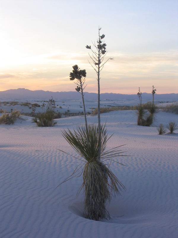 The dunes it forms are amazingly tall. The day we went, kids were sledding down the sides and scrambling up to the top again. We looked at the evidence showing how the dunes moved over time. 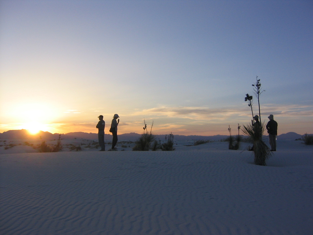 But sunset makes this place magical. The light brings out the colors of the area. People wandered among the plants snapping photos where shadows formed that previously had none. Items in silhouette were stunning against the desert sky.
labels: national park, usa, white sands location: white sands national monument, 19955, alamogordo, nm 88310, usa
0 Comments
As mentioned here, a friend and I traveled around the Four corners region during early May. Of course in the desert region of the south west, I knew the soil would be dry and sandy. However I didn't know the flowers that thrived in that kind of land. These wild flowers were so beautiful and dotted the desert floor. 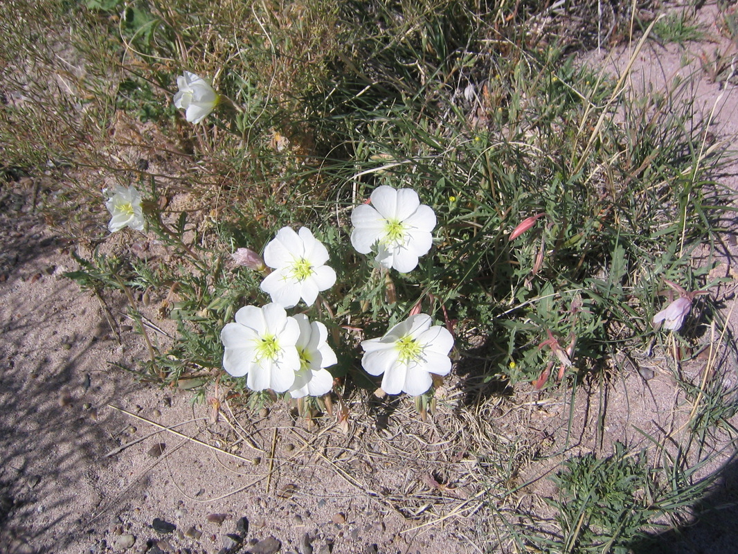 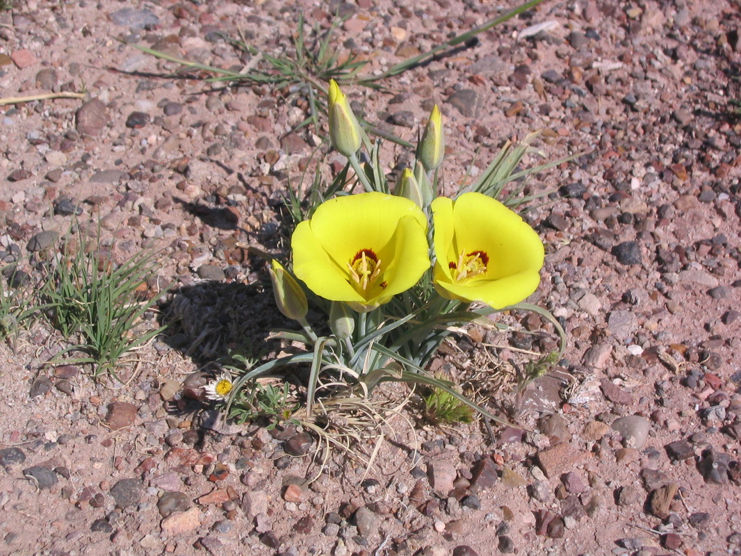 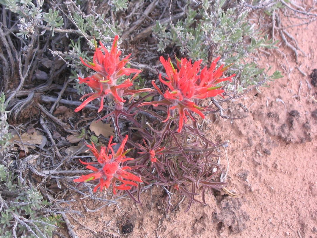 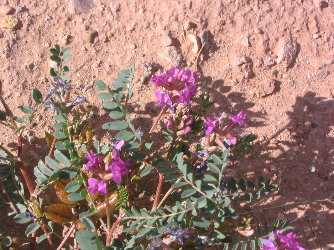 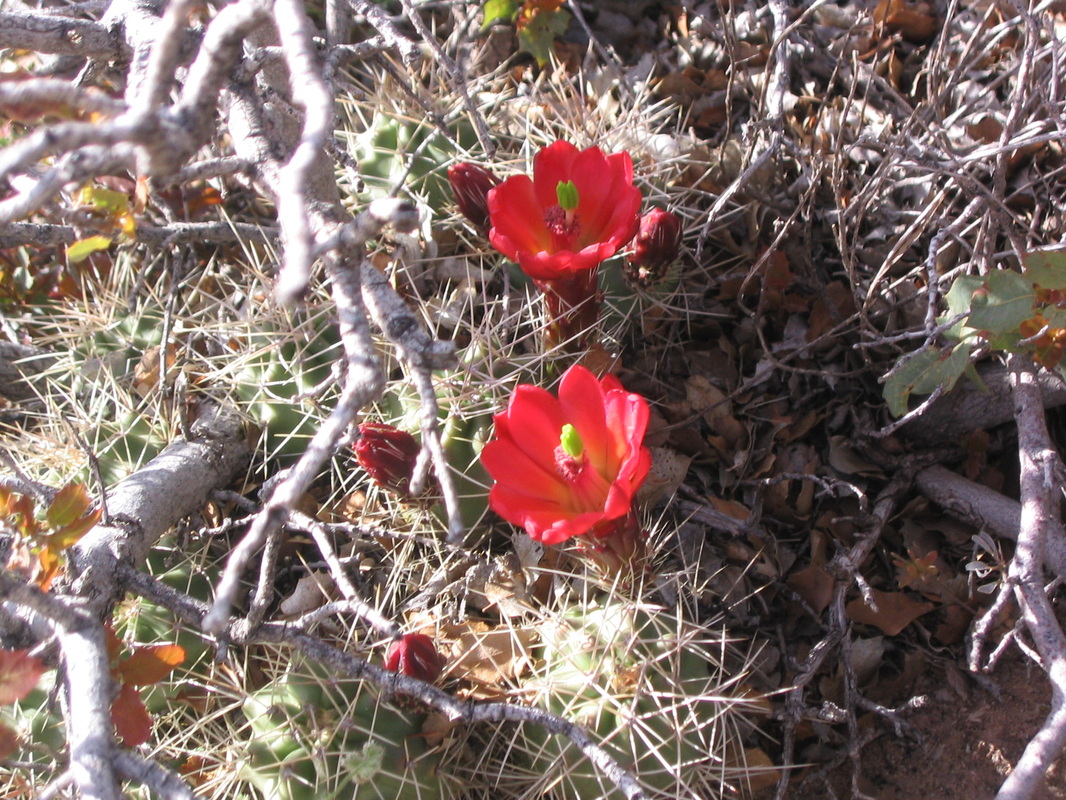 Who has ever fed the fish at the Byodo-In Temple in Hawaii? If so, you likely have a photo just like this one. The temple is built in a valley on the island of Oahu where the light brings out all of the colors of the surrounding area and the air is heavy but cool. Around the temple is a large "lake" of water that is stocked with fish. The nearby gift shop has fish food for sale. So it's common to see people feeding the fish. What was surprising is how active they were at grabbing their next bite. Years later, I went back to this temple. These fish are now almost a foot long and not nearly as cute during fish feeding time. 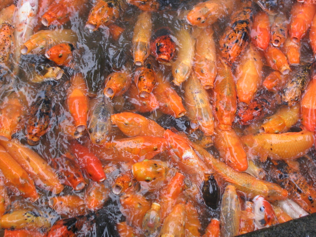 labels: hawaii, usa
location: valley of the temples, 47-200 kahekili hwy, kaneohe, hi 96744-4562, usa After independence from Spain in 1818, the harbor at Valparaiso received all shipping traffic that went between the Atlantic and Pacific oceans as the international port. With the development of the Panama Canal in 1914, this port received less traffic and slowly the city started to diminish in size and wealth. Today the majority of the shipping traffic in Chile goes to another port in San Antonio, about 100 miles south of Valparaiso. But it is hard to tell in this picture. Fishing boats, navy ships and others were in port (with many waiting to dock). If this is a slow day, I can't imagine the traffic that this port used to see. 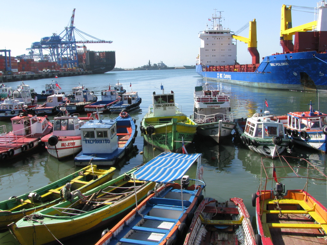 labels: chile, harbor, valparasio
location: valparaíso province, valparaíso, valparaíso region, chile |
About MeTraveling the world one adventure at a time. Archives
December 2012
Categories |
 RSS Feed
